
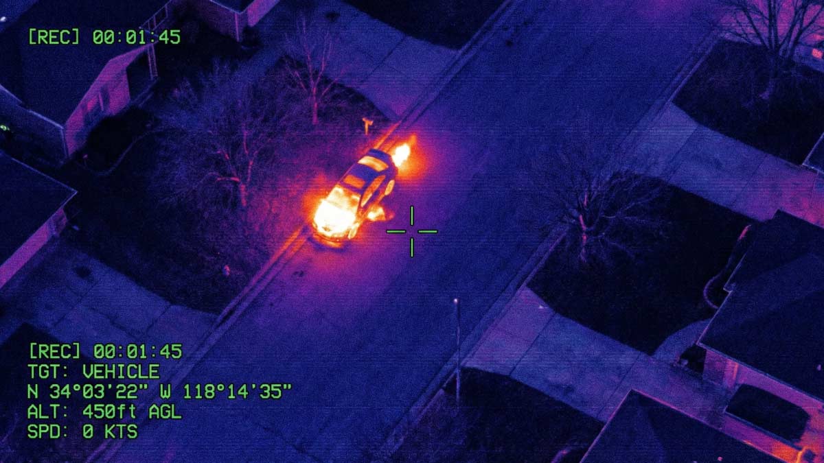
For decades, the challenge in intelligence, surveillance, and reconnaissance (ISR) operations was gaining access to reliable video. Whether supporting military missions, maritime patrols, border security, disaster response, or aerial surveillance programs, operators often worked with limited visibility into unfolding events.
Modern military operations rely on a growing network of ISR video assets to provide commanders with timely and actionable information. From unmanned aerial vehicles (UAVs) operating at the tactical edge to aircraft supporting maritime patrol and intelligence collection missions, ISR platforms generate enormous amounts of video and operational data every day.
Public safety organizations are increasingly adopting similar workflows through Drone as First Responder (DFR) programs, aerial surveillance operations, and emergency response initiatives.
This is where today’s ISR video ecosystems are changing the way organizations operate. By combining Full Motion Video (FMV), metadata, advanced analytics, and collaborative operational tools, ISR workflows can help teams transform raw video into actionable intelligence that can be shared from the tactical edge to the command center.
ISR Is About Context, Not Just Video
Understanding FMV, KLV, and Operational Context
In many ISR operations, metadata is often as valuable as the video itself because it provides the context needed to transform imagery into actionable intelligence.
When people outside the ISR community think about surveillance video, they often imagine a simple camera feed. Experienced operators know there is much more happening behind the scenes. Today, ISR systems deliver not only video but also valuable metadata that provides operational context. One of the most common metadata formats is Key Length Value (KLV), which carries information such as platform location, sensor orientation, altitude, speed, heading, and timestamps alongside the video stream.
This metadata allows operators to understand exactly where a sensor is located and what it is observing at any given moment. Rather than looking at a video feed in isolation, analysts can correlate imagery with maps, mission planning systems, and operational dashboards.
The Growing Role of VMTI and AI-Generated Metadata
The growing adoption of Video Moving Target Indicator (VMTI) data adds another layer of intelligence. VMTI enables systems to identify and track objects within a video stream, providing operators with additional context that can help prioritize attention and improve operational efficiency.
Increasingly, AI-enabled technologies are contributing to this process by generating additional metadata and assisting with object identification and tracking. While human operators remain responsible for decisions, these technologies help teams manage growing volumes of information and focus on the events that matter most.
Drone as First Responder: Improving Response Before Personnel Arrive
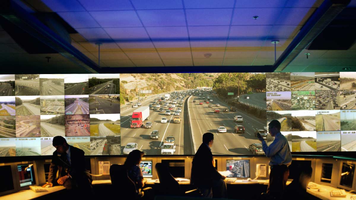
One of the clearest examples of ISR technology moving beyond traditional defense applications is the rise of Drone as First Responder (DFR) programs within public safety organizations. When an emergency call is received, many agencies now deploy drones immediately, allowing command staff and responders to gain visual awareness before personnel arrive on scene.
As live video and metadata are transmitted back to an RTCC, EOC, or command post, operators gain critical context about the incident, including the drone’s location, altitude, direction, and camera position. This allows teams to better understand unfolding events and coordinate response efforts more effectively.
For a deeper look at this workflow, read our blog on Real-Time Video in Drone as First Responder Operations.
Wildfire Monitoring and Emergency Response
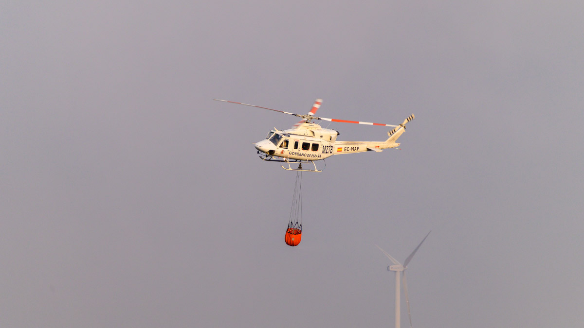
Wildfire response teams rely on aircraft equipped with electro-optical (EO) and infrared (IR) sensors to monitor fire behavior, identify hotspots, and support resource deployment across large operational areas.
By combining live imagery with geospatial metadata and mapping tools, agencies can better understand aircraft positioning, fire movement, and areas requiring attention. As analytics capabilities continue to evolve, additional metadata may help highlight changes in fire behavior and support faster operational assessment.
Maritime Surveillance: Understanding More Than the Target
From Contact Detection to Situational Awareness
Maritime surveillance requires operators to gather and process information across vast operating areas where conditions can change rapidly.
A patrol aircraft monitoring a coastline may identify a vessel that warrants additional attention. At first glance, the video may give the visual confirmation of the vessel, but operational decisions require far more context. Commanders need to understand the location, heading, speed, proximity to sensitive areas, and its relationship to nearby assets.
This is where metadata becomes critical. By combining video with positional information, sensor telemetry, and tracking data, operators gain a more complete understanding of the situation.
The growing use of VMTI and AI-generated metadata can further enhance these workflows by helping operators track objects of interest and maintain awareness across large geographic areas.
Building a Common Maritime Operating Picture
In defense operations, maritime surveillance often involves multiple assets operating simultaneously, including patrol aircraft, unmanned systems, surface vessels, and command centers located hundreds of miles away. A single sensor may detect a vessel, but commanders often need to understand how that contact relates to other intelligence sources, ongoing operations, and mission objectives.
Sharing video, metadata, and tracking information across the operational chain enables commanders to develop a more complete common operating picture and coordinate responses more effectively. For maritime organizations, situational awareness is rarely about a single image. It is about understanding how multiple pieces of information come together to support operational decisions.
Bringing Situational Awareness to the Tactical Edge
Military teams operating in expeditionary environments often need access to multiple video feeds, intelligence sources, and operational data while working from temporary or mobile locations. In these situations, portable ISR capabilities help bring situational awareness closer to the mission by enabling operators to view video, metadata, and operational context without relying on permanent infrastructure.
Platforms such as Kobra are designed to address this challenge by bringing video operations capabilities directly to the tactical edge. By combining multiple video feeds with KLV metadata, VMTI information, and operational context into a single operational view, teams can establish situational awareness rapidly in environments where time and infrastructure are limited.
The value is not simply mobility. The value is ensuring that the people closest to the mission have access to the information they need when decisions must be made quickly.
With the launch of Kobra, the objective is to provide defense, ISR, and emergency response teams with quick and reliable access to video intelligence wherever they are deployed, particularly in environments where traditional infrastructure may not exist. Read more about our recent Kobra launch here.
The Future of ISR Is Contextual Awareness
Situational awareness is no longer defined by simply collecting video. It depends on understanding the operational context behind every frame and delivering that understanding to the people making decisions. As AI-generated metadata, VMTI, and collaborative ISR tools continue to evolve, organizations will increasingly be measured by how quickly they can transform information into action.
As defense, public safety, and emergency response organizations continue to deploy more sensors and collect more data, the challenge is no longer access to information. It is making sense of that information quickly enough to support effective decisions. AI-enabled ISR ecosystems help meet this challenge by bringing together video, metadata, analytics, and collaboration tools to provide a clearer understanding of the operational environment.
Whether supporting Drone as First Responder programs, wildfire response, maritime surveillance, or military operations, the objective remains the same: turning video into actionable intelligence that helps teams respond faster and with greater confidence.
In mission-critical environments, situational awareness is not measured by how much information is available. It is measured by how quickly teams can understand it and act on it.
